
St Michaels Road and West Hill Road are shut to 23 October. Buses replace trains to Poole on Sunday 18 October, and a Sandbanks road closes from 12 October.
Two West Cliff streets are shut from today for gas mains work. St Michaels Road and a short length of West Hill Road, by Tollard Court, are closed to all vehicles until 23 October. Parking then disappears from both sides of West Cliff Road from 19 to 30 October.
Three more dates to put in a diary:
- Monday 12 October: Brudenell Road in Sandbanks closes from Haven Road to Brudenell Avenue, with an anticipated end date of 19 December
- From Monday 12 October, nights: Fountain Roundabout and Barrack Road in Christchurch close from 8pm to 6am for up to seven nights
- Sunday 18 October: no trains between Bournemouth and Poole or Wareham. Buses replace them all day
Last weekend’s rail closure at Brockenhurst is over, and SWR’s summary for this week shows no closures on the Bournemouth line on 10 and 11 October.
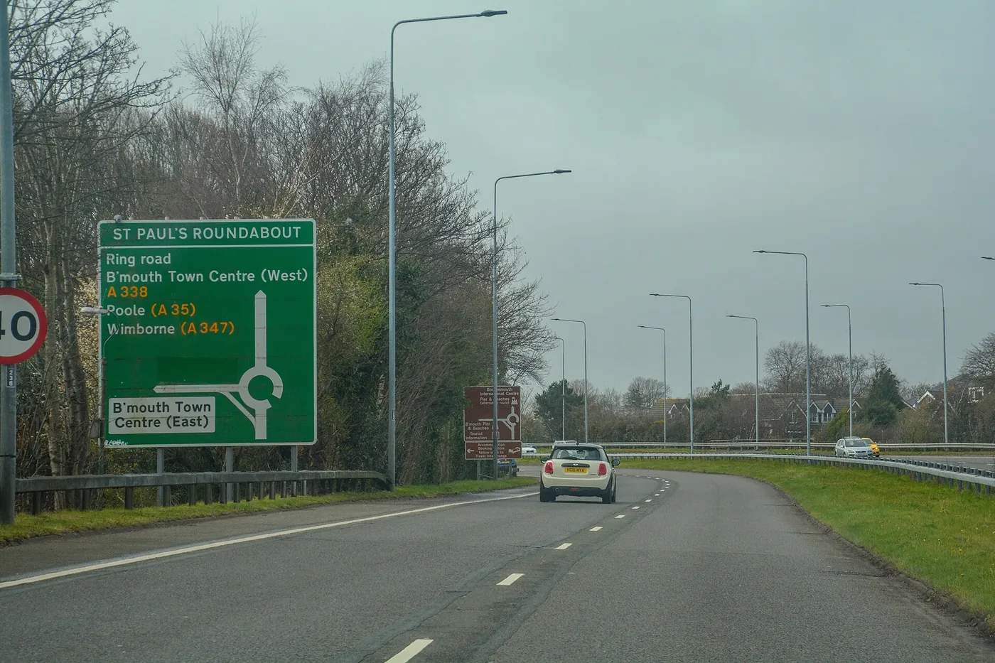
Bournemouth is a town with one motorway-grade road into it and a seafront at the bottom of a cliff. Almost everything arriving from the north or the east comes down the A338 Wessex Way and stops at Bournemouth West Roundabout, and almost everything moving across town uses the A35 Christchurch Road and its western continuation towards Poole. When either of those is dug up, the rest of the network is a set of residential roads that were not built for it.
This page keeps what has changed at the top and the permanent picture underneath. It was last checked on 5 October 2026.
Updated 5 October: new closures added for Brudenell Road, Fountain Roundabout, St Swithuns Road and Oakley Lane, three weekends of rail replacement buses added, and the finished A31, A35 and Brockenhurst closures removed.
Two West Cliff streets closed until 23 October
BCP Council gave notice on 23 September that it intends to make a temporary traffic order for gas works by SGN in the West Cliff hotel quarter. The notice sets out two separate things.
Closed to all vehicles, 5 to 23 October:
- St Michaels Road, from the West Hill Road junction running east for about 56 metres
- West Hill Road, from outside No. 139 (Tollard Court) running south-east for about 26 metres to the St Michaels Road junction
Parking suspended on West Cliff Road, 19 to 30 October. No waiting and no loading at any time, on both sides:
- the southern side, from about 16 metres north-west of the boundary between Nos. 50 and 48, running north-west to the boundary of St Ambrose Church
- the northern side, from about 13 metres south-west of the boundary between Nos. 23 and 25 to 27, running north-west to about 3 metres south-east of the boundary between Nos. 37 and 39
The council says emergency service access will be maintained throughout and access to properties will depend on site safety. Every date in the notice is described as anticipated. As with every temporary order here, the restrictions can legally stay in force for up to 18 months.
SGN now has five gas jobs running on this page at once: West Cliff, Boscombe Gardens, Henville Road and Malmesbury Park Place, St Swithuns Road, and Longfleet Road in Poole. Their dates overlap through October and November.
New this week: Sandbanks, Christchurch and St Swithuns Road
Brudenell Road, Sandbanks, closes on 12 October for ten weeks. BCP Council has made a temporary order closing the road from its junction with Haven Road to its first junction with Brudenell Avenue. The work is a utility connection for Woodmace Concrete Structures. The anticipated dates are 12 October to 19 December. The signed diversion runs via Brudenell Avenue, Shore Road and Haven Road. Sandbanks is about five miles south-west of Bournemouth town centre.
Fountain Roundabout and Barrack Road, Christchurch, close overnight from 12 October. morebus says the closure runs from 8pm to 6am for up to seven nights, and expects the work to be finished by 6am on Saturday 17 October. Buses get special access across the roundabout between the High Street and Bargates. Routes 1a and N2 run via Bargates instead of Barrack Road between the High Street and Stour Road, so the westbound Twynham Avenue and Barrack Road stops are not served. We could find no council notice for this one.
St Swithuns Road loses its parking bay from 12 to 20 October. BCP Council intends to suspend the limited waiting bay on the eastern side, between No. 36 and No. 34, near the Southcote Road corner, for more SGN work.
Oakley Lane, near Canford Magna, closes in three phases from 26 October. The council intends to close it for highway improvement works by Kamm Civil Engineering:
- from Oakley Straight east for about 300 metres: 26 to 29 October
- from Harlequin Drive to Floral Farm: 30 October to 2 November
- from Floral Farm to Canford Magna: 3 to 5 November
The diversion is via Oakley Straight, Merley Lane, Queen Anne Drive and Canford Magna. Oakley Lane is in Poole, about six miles north-west of Bournemouth town centre.
Trunk roads this week
These are the National Highways closures that affect routes to and from Bournemouth, from the closure report covering 2 to 8 October 2026. The main change is the A31 west of Wimborne, which shuts completely at night from Monday to Thursday.
| Road | Where | Nights | Hours |
|---|---|---|---|
| A31 both directions | Bere Regis to Roundhouse, full carriageway closure for resurfacing | Monday 5 to Thursday 8 October | 21:00 to 06:00 |
| A31 westbound | Picket Post entry slip, for resurfacing between Picket Post and Ringwood | Tuesday 6 and Wednesday 7 October | 21:00 to 06:00 |
| A31 westbound | Poulner exit slip, for maintenance | Thursday 8 October | 21:00 to 06:00 |
| A35 both directions | Miles Cross, near Bridport, closure to install temporary barriers and narrow lanes for a roundabout | Tuesday 6 and Wednesday 7 October | 20:00 to 06:00 |
| A36 both directions | Deptford interchange to Wilton roundabout, near Salisbury, for sign and drainage maintenance | Monday 5 to Wednesday 7 October | 20:00 to 06:00 |
Bere Regis is on the A35 and A31 about 18 miles west of Bournemouth. The report names no diversion for the A31 closure. Picket Post and Poulner are just east of Ringwood, about 12 miles north-east of the town centre, where the A338 Wessex Way leaves the A31. The main carriageway there stays open: only the slip roads close.
Two more closures north of the conurbation come from morebus rather than National Highways. The A338 between Downton and Burgate, north of Fordingbridge, is closed overnight from 7pm to 6am from 6 to 11 October while Wiltshire Council replaces cats eyes, and the X3 from Salisbury diverts via Roger Penny Way. And Salisbury Road, the B3347 at Sopley, about four miles north of Christchurch, closes from 7am on Tuesday 6 October to Friday 9 October for Wessex Water. morebus calls it a northbound closure for sewer repairs. Hampshire County Council’s order is wider: it covers the road between Mill Lane and Ringwood Road, 24 hours a day, for a flood prevention project, and expects to need no more than four days. Route 125 cannot serve The Woolpack Inn stop in either direction.
National Highways rewrites these dates in place rather than flagging the change, so check the current report on the day.
The Kinson one-way, in force from 3 September
BCP Council made two experimental orders on 19 August covering Bennion Road and Ibbett Road in Kinson. They came into operation on 3 September 2026, the first day of term, and can run for up to 18 months. The council is trialling them around The Bourne Academy and Kingsleigh Primary School, which between them have in the region of 1,800 pupils.
What has changed on the ground:
- Bennion Road and Ibbett Road are one-way, north to south, from Hadow Road to Kingswell Road, except for cycles
- No entry except cycles from Kingswell Road into Ibbett Road
- Left turn only out of Pavan Gardens onto Ibbett Road
- A 20mph limit on Hadow Road, Bennion Road, Ibbett Road and Pavan Gardens
- New and extended waiting restrictions at the Kingswell Road junctions with Adamsfield Gardens, Kingswell Grove, Kingswell Gardens and Glenville Road, and at the Kinson Road junction with Caroline Road
- Timed disabled parking bays on Hadow Road and outside Kingsleigh Primary School on Pavan Gardens, Monday to Friday 8am to 5pm
We have written the scheme up in full, including what the council says it is trying to fix, in Kinson school streets: Bennion and Ibbett go one-way on 3 September.
On the council’s own roads
Recreation Road has under three weeks to run, the Malmesbury Park gas work is now a made order, and one Poole bus diversion has quietly dropped off the operator’s list.
Recreation Road in Poole is shut every day until 23 October. The council made a temporary order for highway improvement works at the Alder Road and Recreation Road junction, about four miles west of Bournemouth town centre. What the order allows:
- Recreation Road, from Alder Road to Gloucester Road: to 23 October, 08:00 to 19:00
- Alder Road, 50 metres either side of the Recreation Road junction: nights of 21 to 31 October, 19:00 to 06:00
The order and the bus operator still disagree on the dates. morebus now tells passengers the evening diversion for the last two number 15 services to Poole and the last U2 runs 26 October to 4 November, via Yarmouth Road and Cromer Road, which is two days later than it said a fortnight ago. The order allows the night closures only to 31 October, and the order is the legal ceiling.
Parking changes on eight Branksome streets from 12 October. The council made the parking order for its Alder Road to Coy Pond walking and cycling route on 23 September. Its notice says it comes into operation on 12 October. The streets named are Bourne Valley Road, Binnie Road, Coy Pond Road, Dalling Road, Gloucester Road, Library Road, Recreation Road and Sheringham Road, all BH12. The council’s consultation page gives 2 October; we have gone with the date in the legal notice. The 20mph zone in the same scheme has not been decided yet.
Gas works in Boscombe from today. SGN is replacing gas mains at Boscombe Gardens from Monday 5 October to Friday 27 November. Buses cannot stop at Boscombe Gardens or Keverstone Court in either direction, and route 33 will not serve Keverstone Court because of further road closures for the same work. Routes 1a, 1b, 1c, 33, m2, N2 and X3 are affected. The council has still not published a notice for it.
Gas works in Malmesbury Park, now confirmed. On 25 September BCP Council published notice that it has made the order suspending parking for SGN gas main replacement. Its earlier notice had only announced an intention. The dates are:
- Henville Road, western side, about 66m from near Stewart Road: 5 to 30 October
- Malmesbury Park Place, southern side, about 67m from near Holdenhurst Road: 19 October to 13 November
Bays will be suspended in turn as the work moves along each road.
Longfleet Road in Poole: check before you rely on the diversion. morebus said a fortnight ago that SGN’s work had closed Longfleet Road heading away from Poole until 27 November, with sixteen routes diverting. That notice has now gone from the operator’s service updates. Neither morebus nor the council has said the road has reopened early, so we cannot confirm it either way.
Gervis Place in Bournemouth Square stays closed for rebuilding until about 29 January 2027, and no buses use it in the meantime.
Three resurfacing jobs still have no dates. Holdenhurst Road phase 3, from Capstone Place to Wellington Road, waits on “an issue that has been encountered with buried services”. Start dates are “to be announced shortly” for the B3065 The Avenue from Pinecliff Road to Buccleuch Road, and B3061 Ashley Road near Seaview Roundabout. Checked again today, the council’s resurfacing page also still lists Poole Road (Queens Road to Seamoor Road) as “to be announced shortly”, although that job finished on 23 September.
Two town-centre consultations close on 9 October
BCP Council is consulting on closing the stretch of Holdenhurst Road between Lansdowne Roundabout and Bournemouth Station Roundabout to through traffic, leaving it open to buses, taxis and anyone with a destination in the area. Lansdowne Crescent would go the same way and Cotlands Road would become one-way for 31 metres. A second, separate proposal would make part of the St Paul’s Road entry slip a bus lane with no entry except buses.
Both opened on 18 September and both close on Friday 9 October. Quote reference P134 for Holdenhurst Road and M117 for St Paul’s Road. We have set out what each proposal actually changes, and what the council says its reasons are, in Holdenhurst Road: the plan to close it to through traffic.
Trains: three weekends of buses in October
South Western Railway’s summary for 5 to 11 October lists no closures on the Bournemouth line. This weekend’s work is in the Salisbury, Guildford and Staines areas. After that, National Rail lists three weekends that affect Bournemouth directly.
Sunday 18 October: no trains between Bournemouth and Poole or Wareham. All lines are closed between Bournemouth and Wareham for engineering work. Buses replace trains:
- between Bournemouth and Poole, a mix of stopping and direct buses
- between Bournemouth and Wareham
Saturday 24 and Sunday 25 October: no trains between Southampton and Bournemouth. All lines are closed in the Southampton Central area. National Rail says no trains will run between Romsey, Eastleigh or Fareham and Southampton Central or Bournemouth all weekend. On both days SWR buses replace trains between Eastleigh or Southampton Central and Bournemouth, and between Eastleigh and New Milton. CrossCountry trains will not run between Eastleigh and Bournemouth either, and its replacement buses call at Southampton Airport Parkway and Southampton Central.
Saturday 31 October and Sunday 1 November: buses again. The line is closed between Hinton Admiral and Southampton on the Saturday and to Fareham on the Sunday:
- Saturday: no trains between Brockenhurst and Bournemouth. Buses run direct from Southampton Airport Parkway to Bournemouth, and between Brockenhurst and Bournemouth
- Sunday: buses between Eastleigh or Southampton Central and Bournemouth, and between Eastleigh or Southampton Central and New Milton
That Sunday is also the Sandbanks ferry’s last day before its refit, so anyone heading for Purbeck that weekend has two things to plan around.
What else has changed
The Sandbanks ferry stops on 2 November for about seven weeks. The Bournemouth-Swanage Motor Road and Ferry Company announced the dates on 21 September. The last day of service is Sunday 1 November, running normal hours, with the final crossing leaving Shell Bay at 11.10pm. The vessel sails to Poole Quay on Monday 2 November, and the refit is split between Poole Quay and Falmouth. It is a major refit, which the ferry does every other year; the last one was in 2022.
The company says the work will take “a total planned period of 7 weeks, subject to weather and sea conditions”, and that the exact return date will be announced in December. morebus still tells passengers the Purbeck Breezer 50 will be affected from 2 November to 18 December, on “a very changed timetable” to be published nearer the time. The ferry company has not confirmed that date, so treat it as an estimate. General manager Wayne Row said the team appreciated “the ferry is part of the critical transport network for so many people across Dorset”.
Part of Boscombe beach is fenced off from 12 October until March. BCP Council’s contractor, Suttle Projects, starts setting up today to replace the three timber groynes immediately west of Boscombe Pier. Replacement begins on 12 October and is due to finish in March 2027. It is the last stage of a two-year, £2.3 million programme renewing seven groynes between East Cliff and Boscombe. The promenade stays open, but the affected stretch of beach will be fenced. The council asks people to keep away from the construction zone at the water’s edge, even at low tide, and to keep dogs on a lead. Contractors are expected to work Monday to Saturday from 7am to 7pm, and sometimes outside those hours when they need a low tide.
Bournemouth Pier stays open while its landing stages come out. Overnight work to lift around 600 metal grilles off the pier deck started on 21 September and the first phase is expected to take 11 to 12 weeks. We covered what the council found, and what it means for access, in Bournemouth Pier safety work starts 21 September.
Machinery is working on Christchurch beaches until late October. BCP Council says £380,000 of coastal maintenance between Avon Beach and Highcliffe, about six miles east of Bournemouth town centre, began on 7 September and will take up to seven weeks. The beach and promenade stay open, but sections may be cordoned off and machinery is on the beach throughout.
The east cliff lift is still out of action, checked today, after a cliff slide, with monitoring continuing. The land train still does not run west of Bournemouth Pier towards Alum Chine for the same reason, and the council says the trains usually run only until October. The west cliff and Fisherman’s Walk lifts are open, and the council’s price list has changed since we last checked on 24 September:
- £2.45 for a single journey, down from £3
- £7.80 for a group single of four people
- £14.70 for a seven-day pass, down from £15.30
The lifts take card and contactless only. The £47.40 season pass expired on 28 September.
The seafront parking fines trial is over. BCP Council’s trial of higher penalty charge notices ended at 23:59 on 31 August 2026, after running since 4 August across the seafront roads from Sandbanks to Southbourne. The lower tariff has returned to £50 and the higher tariff to £70.
| Offence | Trial rate, to 31 August | From 1 September |
|---|---|---|
| Lower tariff | £110, or £55 within 14 days | £50, or £25 within 14 days |
| Higher tariff | £160, or £80 within 14 days | £70, or £35 within 14 days |
| Unpaid after 28 days | £165 and £240 | £75 and £105 |
| Unpaid after 42 days | £175 and £250 | £85 and £115 |
| Release from car pound | £280 | £105 |
A ticket served during the trial keeps the trial rate even if you pay it now, because the rate is set when the notice is served. The council said on 1 September that the higher fines “helped reduce illegal and inconsiderate parking in the trial area, even at the height of the season”. Its feedback window closed on 30 September, and it is reporting its evidence to the Department for Transport, which decides what happens next. We covered the trial in full in Bournemouth parking fines double for August.
Every permanent parking order in BCP has been replaced by one map-based order. The council made the Parking Regulation, On-Street Parking Places and Off-Street Parking Places Consolidation Order 2026 on 29 July, and it came into operation on 10 August. It revokes all previous permanent parking orders across the three towns and reproduces them, in the council’s words, “without addition or amendment to the schedules”. Nothing on the ground changes. What changes is that the restriction on your street is now defined by a map rather than by a schedule of road names, which is the version a traffic warden and an adjudicator will work from. The six-week window to challenge its validity in the High Court closed on 18 September.
Where to check live roadworks
BCP Council does not publish its own roadworks list. It points at one.network, which carries planned works, emergency works, closures and events for the whole conurbation on a single map. It is the same feed the council’s own roadworks page links to, so there is no better source and no need to hunt for one. Each of the council’s traffic orders above carries its own one.network reference.
For the trunk network beyond the town, the A31 towards the M27 and Southampton is National Highways rather than BCP, and its closures appear on National Highways traffic information instead.
The change coming in spring 2027
On 30 July 2026 the council confirmed that the Secretary of State for Transport had approved a Local Lane Rental Scheme for Bournemouth, Christchurch and Poole, making BCP the first local authority in the South West to get one. The council now says a 12-week shadow scheme, with no charges, starts on Wednesday 6 January 2027, and charging starts on Thursday 1 April 2027.
Lane rental lets a highway authority charge a daily fee, up to £2,500 a day, for works on its busiest roads at its busiest times. It applies to the council’s own contractors as well as to utility companies. The point is not the money, it is the incentive: work at night or at the weekend, or share a trench with the next company, and you pay nothing.
The council’s report to committee puts numbers on it. Delays caused by street works across BCP currently cost an estimated £14.7 million a year in lost time. The scheme is expected to raise about £2.3 million a year, leaving roughly £1.8 million after running costs, of which about £900,000 a year is ringfenced for road maintenance and further measures to cut disruption. Of the 156 people and organisations who responded to the consultation, 85% of individuals and 73% of businesses agreed with the proposal.
Cllr Andy Hadley, BCP Council’s portfolio holder for highways, said: “We know just how frustrating roadworks can be for our residents, but we also know how important it is to improve our transport network, infrastructure and maintain and renew essential services.”
The council points to West Sussex, where in the first 16 months of a lane rental scheme the time taken by roadworks fell by a combined 3,083 days and the duration of utility works fell by 32.48%.
Which Bournemouth roads are on the list
The scheme covers just over 100 stretches of road across the three towns, selected from the council’s traffic-sensitive street network. Regulations cap the lane rental network at 10% of that traffic-sensitive network, so this is deliberately the worst tenth rather than a general charge.
The striking thing about the Bournemouth entries is how many of them are not roads at all. Nine are roundabouts.
The named Bournemouth streets in the scheme include Christchurch Road, Holdenhurst Road, Castle Lane East, Wallisdown Road, Talbot Avenue, Talbot Road, Lansdowne Road, Bellevue Road, Alma Road, Bath Road, Poole Hill, Seamoor Road, Seabourne Road, Southbourne Grove, Westover Road, Gervis Place, Exeter Road and Whitelegg Way. If you live on one of them, the practical effect from spring 2027 should be shorter disruption rather than none.
The roads that carry Bournemouth
Whatever is dug up in any given week, these are the routes that decide how the town moves.
- A338 Wessex Way. The only fast road in. It brings traffic from the A31 and the M27 down the Stour valley and ends at Bournemouth West Roundabout. There is no parallel route, so an incident on the Wessex Way pushes traffic onto Castle Lane East and Wimborne Road.
- A35 Christchurch Road and Poole Road. The east to west spine, running from Christchurch through Pokesdown, Boscombe and the Lansdowne to the town centre, then out through Westbourne to Poole. It is the longest designated stretch in the lane rental scheme at 5.36km.
- A3060 Castle Lane East. The northern bypass most people use when the town centre is blocked, linking the A338 at Cooperdean to Wimborne Road.
- A347 Wimborne Road and Charminster Road. The main road north through Charminster, Winton and Moordown to Ensbury Park, with four designated roundabouts on it in under three miles.
- A3049 Wallisdown Road and Alma Road. The western route to Poole and the university campuses, part-rebuilt in phases since 2020.
Parking, and the cheaper ways to move
The main car park at Bournemouth station on Holdenhurst Road is run by APCOA, has 362 spaces and charges £6 a day Monday to Friday, £3 from midday, £3 at weekends and £836 a year. A premium car park of 52 spaces sits next to it. Full commuting costs are on our Bournemouth train times to London page.
Beryl runs the shared bikes and e-scooters under a five-year contract with the council. There are over 1,000 bikes across more than 300 bays, hire is 8p a minute, and leaving one outside a bay costs you a £5 charge. Two rules catch people out: no cycling on the Bournemouth or Poole promenade between 10am and 6pm in July and August, and e-scooter hire needs you to be over 18 with a provisional or full UK driving licence, which Beryl verifies before it will unlock one. The e-scooter trial runs to May 2028, and privately owned e-scooters remain illegal on all public roads.
There is no park and ride serving Bournemouth town centre.
Frequently asked questions
What roads are closed in Bournemouth this week?
St Michaels Road and part of West Hill Road in West Cliff are closed for gas works until 23 October, and Gervis Place remains shut for rebuilding until 29 January 2027. In Poole, Recreation Road is closed from Alder Road to Gloucester Road, 08:00 to 19:00 daily until 23 October. From 12 October, Brudenell Road in Sandbanks closes until 19 December, and Fountain Roundabout in Christchurch closes overnight for up to seven nights.
Is the A31 shut at night this week?
Yes, west of Wimborne. The A31 is closed in both directions between Bere Regis and Roundhouse from 9pm to 6am, Monday 5 to Thursday 8 October, for resurfacing. Near Ringwood only slip roads close: the westbound Picket Post entry slip on 6 and 7 October and the westbound Poulner exit slip on 8 October.
Are there trains from Bournemouth in October?
Yes, but not on every weekend. On Sunday 18 October buses replace trains between Bournemouth and Poole or Wareham. On 24 and 25 October no trains run between Southampton and Bournemouth, and on 31 October and 1 November buses replace trains between Brockenhurst or Southampton and Bournemouth. The weekend of 10 and 11 October has no closures on the Bournemouth line.
When does the Sandbanks ferry close?
Its last day of service is Sunday 1 November 2026, with the final crossing leaving Shell Bay at 11.10pm. It goes out of service on Monday 2 November for a major refit of about seven weeks at Poole Quay and Falmouth. The company says the exact return date will be announced in December.
Where can I check Bournemouth roadworks?
On one.network, which is where BCP Council sends you. It shows planned and emergency roadworks, closures and events across Bournemouth, Christchurch and Poole on one map. The council does not maintain a separate list.
What is being proposed for Holdenhurst Road?
BCP Council wants to ban through traffic on Holdenhurst Road between Lansdowne Roundabout and Bournemouth Station Roundabout, keeping it open to buses, taxis and vehicles with a destination in the area. Comments quoting reference P134 must reach the council by Friday 9 October 2026.
Why is part of Boscombe beach fenced off?
BCP Council is replacing the three timber groynes immediately west of Boscombe Pier. Site set-up starts on 5 October, replacement on 12 October, and the work is due to finish in March 2027. The promenade stays open.
What has changed on Bennion Road and Ibbett Road?
Since 3 September 2026 both roads are one-way north to south except for cycles, with a 20mph limit covering them plus Hadow Road and Pavan Gardens. BCP Council made the experimental orders on 19 August and is trialling them around The Bourne Academy and Kingsleigh Primary School. Comments are open until 3 March 2027.
What is the BCP lane rental scheme?
A government-approved scheme that lets the council charge up to £2,500 a day for works on its busiest roads at its busiest times. A 12-week shadow scheme starts on 6 January 2027, without charges, and charging starts on 1 April 2027. BCP is the first council in the South West to run one.
Why is the east cliff lift closed?
A cliff slide put it out of action and monitoring of the site is ongoing. The west cliff and Fisherman’s Walk lifts are still running at £2.45 a single journey.
Which is the busiest road in Bournemouth?
By designated length in the lane rental scheme, the A35 Christchurch Road at 5.36km, followed by Holdenhurst Road at 3.05km. By consequence when it fails, the A338 Wessex Way, because nothing else does its job.
Sources
- National Highways road closure report for every trunk-road closure in the table, from the workbook covering 2 to 8 October 2026, downloaded 5 October 2026.
- BCP Council West Cliff Road and associated roads, Bournemouth, gas works temporary traffic regulation order 2026, published 23 September 2026 for the St Michaels Road and West Hill Road closures, the West Cliff Road parking suspensions, the anticipated dates, the SGN attribution and the 18-month ceiling.
- BCP Council Brudenell Road, Poole, road closure temporary traffic regulation order 2026, published 28 September 2026 for the closure extent, the Woodmace Concrete Structures works, the 12 October to 19 December dates and the diversion.
- BCP Council St Swithuns Road parking bay suspension notice, published 25 September 2026 for the bay suspension and its 12 to 20 October dates.
- BCP Council Oakley Lane, Poole, road closure notice, published 28 September 2026 for the three phases, the dates and the diversion.
- BCP Council Henville Road and Malmesbury Park Place gas works order, notice of making published 25 September 2026 for the parking suspensions and their anticipated October and November dates.
- Hampshire County Council, B3347 Salisbury Road, Sopley, temporary road closure notice, published 24 September 2026 for the closure extent, the Wessex Water flood prevention works and the four-day estimate.
- morebus service updates for the Fountain Roundabout and Barrack Road overnight closure, the Sopley closure from 6 to 9 October, the A338 Downton to Burgate night closures, the Boscombe Gardens gas works to 27 November, the Gervis Place closure to 29 January 2027, the Alder Road evening diversions to 4 November and the route 50 dates, checked 5 October 2026. The Longfleet Road notice was no longer listed.
- National Rail, Bournemouth and Poole / Wareham engineering works, 18 October 2026, Southampton Central, 24 and 25 October and Southampton Central, 31 October and 1 November for the three weekend closures and their replacement buses, read 5 October 2026.
- South Western Railway engineering work weekly summary for 5 to 11 October 2026 for the weekend closures in the Salisbury, Guildford and Staines areas and none on the Bournemouth line.
- The Sandbanks Ferry, 2026 refit dates announcement, 21 September 2026 for the 1 November last day of service, the 11.10pm final crossing, the 2 November move to Poole Quay, the seven-week planned period, the Poole Quay and Falmouth split, the 2022 last major refit and the Row quote.
- South West Flood and Coastal, Bournemouth Beach timber groyne renewal, winter 2025 to 2027 for the three Boscombe Beach West groynes, the 5 and 12 October dates, the March 2027 completion, the £2.3 million budget and the contractor, and BCP Council, coastal defence works near the PierView Room for the working hours and access.
- BCP Council, resurfacing schemes for the Holdenhurst Road phase 3 position and for Poole Road, B3065 The Avenue and B3061 Ashley Road still being listed with start dates “to be announced shortly”, checked 5 October 2026.
- BCP Council Alder Road and Recreation Road, Poole, Temporary Traffic Regulation Order 2026, published 18 September 2026 for the made closure dates, times and extents.
- BCP Council, Active Travel Fund, Alder Road to Coy Pond (reference P129) and its notice of making for the 23 September order, the 12 October operative date, the eight streets and the undecided 20mph zone.
- BCP Council, Bus Service Improvement Plan (BSIP) Holdenhurst Road (reference P134 and M114) and BSIP St Paul’s Road Entry Slip (reference M117) for the two proposals, the 18 September opening and the 9 October deadline.
- BCP Council, Bennion Road and Ibbett Road Experimental Traffic Order consultation (reference E1 2026) and the E1 2026 deposit document for the one-way, the 20mph zone and the parking restrictions.
- Notice of making of the Bennion Road and Ibbett Road experimental orders, published 21 August 2026 for the 19 August making date, the 3 September operative date and the schedule of restrictions.
- BCP Council Parking Regulation Consolidation Order 2026 notice, published 7 August 2026 for the 29 July making date, the 10 August operative date and the six-week High Court window.
- BCP Council, trial for increased parking fines and penalty charge notices for the trial end date and both sets of rates, and second higher parking fines trial ends as evidence is reviewed, 1 September 2026 for the Department for Transport review and the 30 September feedback deadline.
- BCP Council, green light for new powers to significantly cut roadwork disruption across BCP, 30 July 2026 for the lane rental approval, the £2,500 daily cap, the West Sussex figures and the Hadley quote, and BCP Council, lane rental scheme for the 6 January 2027 shadow scheme and 1 April 2027 charging dates.
- BCP Council Lane Rental Scheme report, Our Place and Environment Overview and Scrutiny Committee for the designated street list, the 10% cap, the consultation results and the revenue and delay-cost estimates.
- BCP Council, roadworks, temporary closures and restrictions for the one.network referral.
- BCP Council, Bournemouth cliff lifts and Bournemouth land trains for the closures and the fares, checked 5 October 2026.
- BCP Council, coastal maintenance work starts at Christchurch beaches, 8 September 2026 for the £380,000 cost, the Avon Beach to Highcliffe extent, the 7 September start and the seven-week estimate.
- APCOA, Bournemouth Station car park for station parking tariffs.
Checked on 5 October 2026. Roadworks change daily, and the National Highways report is republished every working day, so always confirm against one.network before you set off. What is being built, and where, is on our Bournemouth planning news page; what is open on the seafront is on things to do in Bournemouth.
Have your say